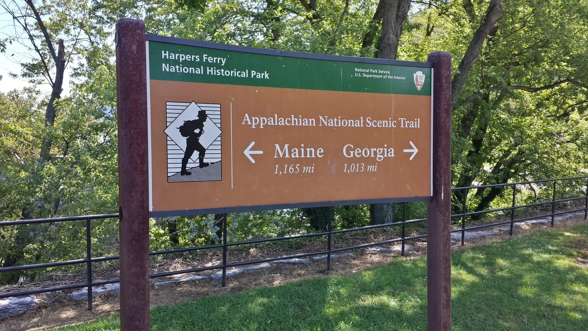
The Appalachian Trail runs straight through Harpers Ferry, West Virginia. The white blazes come down off Loudoun Heights, cross the Shenandoah, climb past Jefferson Rock and drop through Lower Town to The Point, where the trail normally crosses the Potomac into Maryland. The Appalachian Trail Conservancy (ATC) has its headquarters here, and its visitor center is where thru-hikers stop for the famous halfway photo. This guide covers the visitor center, the route through town, the best short sections for day hikers, overnight parking, and what the footbridge closure means as of November 2026.
Know before you go
| ATC Visitor Center | 799 Washington St, Harpers Ferry; 304-535-6331 — ATC |
| Hours (Nov 2026) | Thu–Mon 9am–5pm; Tue–Wed 10am–4pm |
| ATC parking | 2-hour lot behind the building, from Storer College Place |
| Overnight parking | NPS Visitor Center lot, 171 Shoreline Dr, up to 14 days by permit — NPS |
| A.T. in West Virginia | 2.4 mi fully in the state; 0 shelters; no camping in town or the park |
| Footbridge to Maryland | Closed since Jul 27, 2026 — closure details |
| Dogs | Leash required in Harpers Ferry NHP and all of Maryland — ATC |
Is Harpers Ferry the halfway point of the Appalachian Trail?
Harpers Ferry is the A.T.'s "psychological halfway point," not the mileage midpoint. The ATC uses that phrase for its Harpers Ferry headquarters ("psychological midpoint" on its visitor center page). The true halfway point by distance is in Pennsylvania, and it shifts from year to year as the trail is rerouted.
The label fits because of what happens here rather than the math: the ATC's headquarters is in town, the trail passes within a short side trail of its door, and thru-hikers stop for the halfway photo on its porch. Many "flip-flop" thru-hikers also start their hikes at the ATC Visitor Center, per the ATC's West Virginia page. The ATC and local partners hold a free Flip-Flop Kickoff each April; in 2026 it ran April 24–26, and 2027 dates aren't posted yet (ATC).
What is at the ATC Harpers Ferry Visitor Center?
The ATC Harpers Ferry Visitor Center, at 799 Washington Street, is part museum, part hiker hub and part shop. According to the ATC, you'll find:
- A 10-foot 3-D map of the whole trail, with a miniature shelter built into the back.
- The sign from the top of Katahdin, the trail's northern end in Maine.
- A story wall about notable hikers, including Earl Shaffer, "Grandma Gatewood" and "2-Mile Marcy."
- A gift shop with ATC merchandise. Maps and guidebooks are sold through the ATC's partner, Mountaineers Books.
- Passport stamps: the Passport to Your National Parks stamp for the Appalachian National Scenic Trail, plus two A.T. passport stamps.
- A Junior Ranger/Adventure Guide for the A.T. in Harpers Ferry, which kids can download ahead of time and complete for a badge.
Hours (as of November 2026): Thursday to Monday 9am–5pm, Tuesday and Wednesday 10am–4pm. The ATC posts unexpected closures on its Trail Updates page.
Parking: a small two-hour lot behind the building, reached from Storer College Place, plus metered street parking below the center on Washington Street. From Lower Town, you can walk up High Street or take the A.T. and its blue-blazed side trail (see the Town Loop below).
What is the hiker photo tradition?
Thru-hikers have their picture taken on the front porch of the ATC Visitor Center to mark reaching the trail's psychological midpoint. The ATC has cataloged these "halfway" photos at the building since 1979, and you can browse past years in its online Hiker Photo Archive or request a copy. The ATC's state page adds that hikers have stopped to photograph the headquarters sign since the 1970s.
What does the visitor center offer thru-hikers?
The hiker lounge has a couch, a computer, power outlets, space to drop packs, cold drinks for sale and information on local services. There's a restroom and free wifi. The ATC accepts hiker packages for a suggested $5 donation, addressed to "Attn: Hiker" plus your name at 799 Washington Street; you can also use the Harpers Ferry Post Office.
Where does the Appalachian Trail go through Harpers Ferry?
The A.T. crosses Harpers Ferry from south to north in a few miles, linking Loudoun Heights, Jefferson Rock, Lower Town and the Potomac footbridge. Northbound, the route through town goes like this, based on the NPS and ATC route descriptions:
- Off Loudoun Heights and over the Shenandoah. The A.T. descends Loudoun Heights to the US 340 highway bridge, where hikers use the bridge's hiker section to cross the Shenandoah (NPS).
- Up to Jefferson Rock. From the bridge, the white-blazed A.T. runs about 1 mile to Jefferson Rock above the Shenandoah. Don't climb or stand on the rock; it's prohibited (NPS).
- Past Harper Cemetery and St. John's ruins. Near Jefferson Rock the trail passes the stone steps up to Harper Cemetery and the ruins of St. John's Episcopal Church, which the ATC says was destroyed by shelling in the Civil War.
- Down into Lower Town. The trail drops on wooden and stone steps to Church Street and High Street, then down through Lower Town past park exhibits.
- To The Point and the footbridge. The A.T. reaches The Point, where the Shenandoah meets the Potomac, and crosses the Goodloe Byron Memorial Footbridge into Maryland at A.T. northbound mile 1,026.7 (ATC). On the Maryland side it follows the C&O Canal towpath downstream to Weverton before climbing South Mountain.
A blue-blazed side trail connects the A.T. to the ATC Visitor Center through the former Storer College campus. The ATC counts just 2.4 miles of trail fully in West Virginia, the shortest of any state, plus about 20 miles along the West Virginia–Virginia border. Elevations in the state range from 265 to 1,200 feet.

What are the best Appalachian Trail day hikes from Harpers Ferry?
The best A.T. day hikes from Harpers Ferry range from a 1.4-mile town loop to a long ridge climb. Here are the sections that work as day trips as of November 2026:
| Hike | Distance | Rating | Footbridge needed? | Notes |
|---|---|---|---|---|
| Harpers Ferry Town Loop | 1.4 mi loop | Moderate (ATC) | No | Starts at the ATC Visitor Center; Storer College, Jefferson Rock, St. John's ruins, High Street |
| Camp Hill & A.T. | Up to 1.8 mi round trip, up to 216 ft | Moderate (NPS) | No | Tree-lined A.T. past the former Storer College campus |
| Loudoun Heights | Up to 7.5 mi round trip, 1,377 ft | Moderately strenuous (NPS) | No | A.T. up from the Shenandoah bridge, then a blue trail to Split Rock |
| Weverton Cliffs | 2.0 mi round trip | Moderate (ATC) | No; you drive to Maryland | A.T. switchbacks to cliffs above the Potomac |
Sources: ATC Town Loop, NPS Hiking Trails, ATC Weverton Cliffs.
The Harpers Ferry Town Loop is the best short sample. The ATC's route: leave the visitor center on the blue-blazed side trail through the iron gateway into the Storer College campus, follow the brick path and stairs into the woods, and turn left on the A.T. Go downhill over rock and stone steps past Harper Cemetery (at 0.3 mile) and Jefferson Rock, then past St. John's ruins into town on Church Street. Leave the A.T. at High Street and walk uphill back to the visitor center. For a short extension, stay on the A.T. down to The Point.
Maryland Heights, the most famous hike in town, is not on the A.T.; it is a separate NPS trail across the Potomac. See our Maryland Heights Trail guide.

My favorite short stretch
The climb from Lower Town up the stone steps, past St. Peter's and the ruins of St. John's Episcopal Church, to Jefferson Rock. It's short and steep, and the view keeps opening up as you go. I walked it on a clear September morning, and I'd go in the morning again.

How does the footbridge closure affect the Appalachian Trail?
The closure cuts the A.T. at the Potomac: as of November 2026 you cannot walk the trail from Lower Town into Maryland. The Goodloe Byron Memorial Footbridge has been closed since July 27, 2026, first for stair replacement and, since October, for separate deck safety repairs. No reopening date has been announced. The full timeline is on our footbridge closure page.
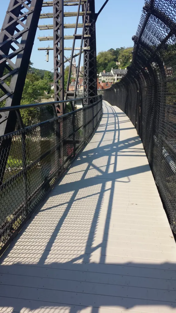
What the ATC recommends (ATC update, Nov 5, 2026):
- Thru-hikers and long-distance hikers should arrange their own transportation across the river. The ATC Visitor Center can help you find a ride, and the ATC's Transportation page lists shuttle options.
- Other A.T. hikers are strongly advised to choose other hikes or hike only on one side of the Potomac.
- The NPS shuttle runs between the park Visitor Center and C&O Canal Lock 34 only. As of November 2026 the first bus leaves the Visitor Center at 9:00am and the last leaves Lock 34 at 5:30pm. Space is very limited, pets are not allowed, and it doesn't run in bad weather. Lock 34 is 0.9 miles upstream (west) of the footbridge, so northbound hikers walk back downstream along the towpath to rejoin the A.T.
Hiking with a dog during the closure
Pets aren't allowed on the Lock 34 shuttle. If you're hiking the A.T. with a dog, you'll need a private ride across the river. The NPS names two commercial shuttle operators on its bridge page: River & Trail Outfitters (301-834-9950) and Shepherdstown Pedal & Paddle (304-876-3000). Ask them about dogs when you book.
Where can A.T. hikers park overnight in Harpers Ferry?
A.T. hikers can park overnight only in the Harpers Ferry National Historical Park Visitor Center lot at 171 Shoreline Drive, for up to 14 days, with an approved vehicle permit. The NPS parking page says:
- Ask for a vehicle permit form at the Visitor Center during its 9am–5pm hours, or request one by email. Email replies can take up to three days and the inbox isn't monitored on weekends. Applications are subject to approval.
- Park entrance fees apply. As of November 2026 the vehicle pass is $20 and covers 3 consecutive days; ask the park what applies for a longer stay. See our parking, fees and shuttle guide.
- You may not sleep or camp in your vehicle.
The ATC's own lot behind its visitor center is limited to 2 hours. Note that the Visitor Center lot is 1.4 miles west of where the A.T. crosses Shoreline Drive (ATC), so plan on a walk or the park shuttle to reach the trail.
Can you camp on the Appalachian Trail in Harpers Ferry?
No. The ATC says there is no camping in the town of Harpers Ferry or in Harpers Ferry National Historical Park, and the West Virginia section has no shelters. In Maryland, the ATC says camping is allowed only at designated overnight sites. For campgrounds, hostels and rooms nearby, see camping near Harpers Ferry and where to stay.
Are dogs allowed on the A.T. in Harpers Ferry?
Yes, on a leash. The ATC says leashes are required on the A.T. in Harpers Ferry National Historical Park and in all of Maryland, and the park sets a 6-foot maximum (NPS). Pets aren't allowed in park buildings or on the park shuttles. More tips are in Harpers Ferry with dogs and kids.
For every trail in and around town, see the Harpers Ferry hiking guide.