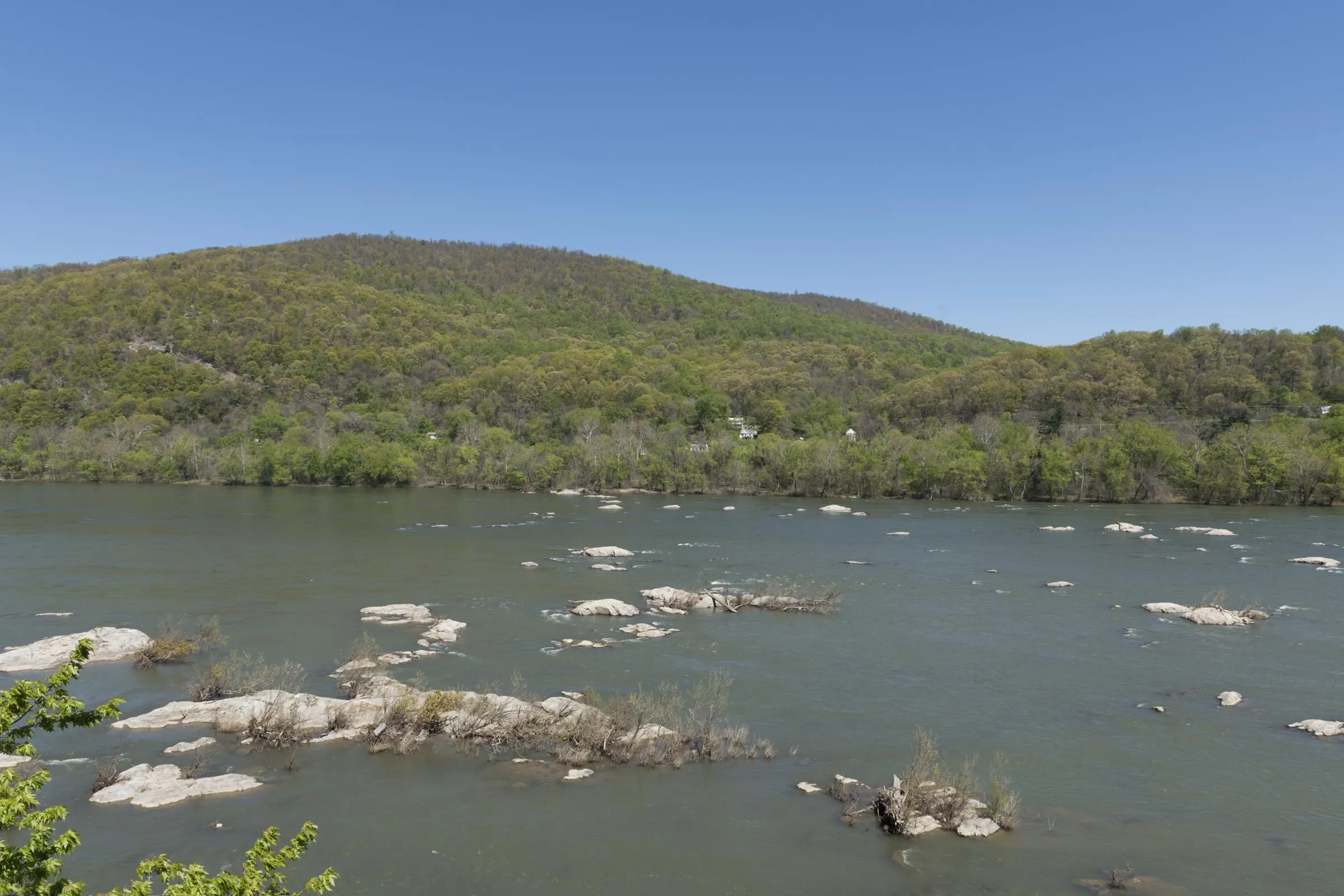
Loudoun Heights is the steep, wooded ridge across the Shenandoah River from Lower Town Harpers Ferry. It is the first peak of the Blue Ridge south of the Potomac, about 1,175 feet high (Wikipedia, citing USGS data), and the Appalachian Trail climbs it on the way south. The Loudoun Heights Trail adds a blue-blazed ridge walk past several overlooks to Split Rock, with views back over the town and both rivers. As of November 2026 it is open, and the Potomac footbridge closure doesn't affect it.
Know before you go
| Distance | Up to 7.5 mi round trip — NPS |
| Climb | 1,377 ft |
| Difficulty | Moderately strenuous (NPS quick facts); the trail description calls it strenuous |
| Time | 4–5.5 hours |
| Start | US 340 bridge over the Shenandoah, then the white-blazed A.T. |
| Trails | White-blazed A.T. for 1.3 mi, then the blue-blazed trail to Split Rock |
| Water & restrooms | None on the trail; at the Visitor Center and in Lower Town |
| Hours | Trail open in daylight, closed sunset to sunrise (NPS) |
| Parking | Visitor Center, 171 Shoreline Dr — parking guide |
| Footbridge closure | Doesn't affect this hike |
How long and how hard is the Loudoun Heights Trail?
The Loudoun Heights Trail is up to 7.5 miles round trip with 1,377 feet of climbing, according to the NPS Loudoun Heights page. The NPS quick facts rate it moderately strenuous and give 4 to 5.5 hours; its trail description calls it strenuous and says 4 to 5 hours. The NPS hikes page adds that it is steep and rocky in places.
That makes Loudoun Heights the longest trail on the NPS list for Harpers Ferry and a bigger day than Maryland Heights. Start early so you have daylight to spare: the trail closes at sunset.
Where does the Loudoun Heights Trail start?
The Loudoun Heights Trail starts at the US 340 highway bridge over the Shenandoah River, just upstream of Lower Town. The NPS route: cross the hiker-friendly section of the highway bridge, take the staircase under the bridge to the base of Loudoun Heights, and follow the white-blazed Appalachian Trail uphill.
You can reach the bridge on foot three ways, per the NPS:
- From Lower Town via Jefferson Rock. Take the Camp Hill and Appalachian Trail from High Street up the stone steps to Jefferson Rock, then follow the white-blazed A.T. about 1 mile to the highway bridge. This is the A.T. route itself.
- From Lower Town along the river. Walk the Virginius Island and Hall's Island trails along the Shenandoah shoreline to the bridge.
- From the Visitor Center. Take the Visitor Center to Lower Town Trail to the highway bridge, then turn left through the River Access parking lot.

What is the route to Split Rock?
From the Shenandoah bridge, the route to Split Rock follows the A.T. up the mountain and then the blue-blazed trail along the ridge. Here it is as the NPS describes it:
- Climb the A.T. From the base of Loudoun Heights, follow the white-blazed A.T. for 1.3 miles to the junction with the blue-blazed trail. Turn left.
- First overlook. About 0.4 miles along the blue trail is the first overlook.
- The crest. The summit is 0.25 miles past the first overlook. Turn left at the crest. The NPS says this stretch gives the park's only view east into Pleasant Valley and beyond, and a southern view of the town and the confluence.
- Power line overlooks. Two more overlooks along the power line cut come before Split Rock.
- Split Rock Overlook. It is 1.3 miles from the crest.
- Return. Come back on the blue-blazed trail to the A.T., then descend to the bridge and Lower Town.
Along the way the NPS points out formations of phyllite and quartzite rock. Watch the blazes at each junction: white is the A.T., blue is the Loudoun Heights Trail.
What is Split Rock, and what can you see from it?
Split Rock is the overlook at the end of the Loudoun Heights Trail, 1.3 miles past the crest. The NPS calls it a "beautiful vista," and Wikipedia, citing the NPS, describes good views of the confluence of the Potomac and Shenandoah and of Harpers Ferry. Along the whole trail you get several views of the town, the two rivers and their valleys, and of Maryland Heights across the Potomac.
Is Loudoun Heights or Maryland Heights the better hike?
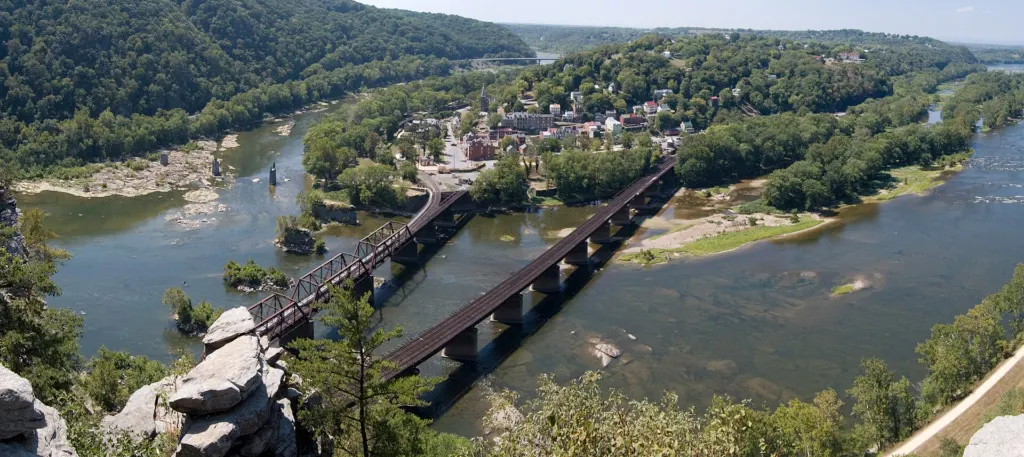
Maryland Heights has the famous view straight down on Lower Town, but Loudoun Heights is easier to reach in November 2026 and is the more natural choice while the footbridge is closed. Loudoun Heights is longer, with a quieter ridge walk; Maryland Heights is shorter and ends at a cliff edge above the town.
| Loudoun Heights | Maryland Heights | |
|---|---|---|
| Round trip | Up to 7.5 mi | 4.5–6.5 mi from the trailhead |
| Climb | 1,377 ft | 990–1,788 ft |
| Time | 4–5.5 hr | 3–4 hr |
| Difficulty (NPS) | Moderately strenuous | Moderately strenuous to strenuous |
| Side of the rivers | Across the Shenandoah, reached by the US 340 bridge | Maryland, across the Potomac |
| Access (Nov 2026) | Walk from Lower Town or the Visitor Center | NPS shuttle to C&O Lock 34, then the towpath |
| Dogs | Leashed; walk in from the Visitor Center | Leashed on the trail, but no pets on the shuttle |
| The view | Looks across the town and rivers to Maryland Heights | Looks straight down on Lower Town and the confluence |
Figures are from the NPS Loudoun Heights and Maryland Heights pages. For the shuttle workaround, see our Maryland Heights Trail guide.
Is Loudoun Heights affected by the footbridge closure?
No. Loudoun Heights is reached over the US 340 bridge across the Shenandoah, not the Potomac footbridge, so the closure doesn't touch it. The Goodloe Byron Memorial Footbridge has been closed since July 27, 2026; current status is on our footbridge closure page. The Appalachian Trail Conservancy suggests that hikers stay on one side of the Potomac during the closure, and the A.T. from Lower Town over Loudoun Heights is the obvious way to do that on the West Virginia side.
Where do you park for Loudoun Heights?
Park at the Harpers Ferry National Historical Park Visitor Center, 171 Shoreline Drive, the NPS's main parking area for the trail. From there, walk the Visitor Center to Lower Town Trail to the Shenandoah bridge, or ride the park shuttle to Lower Town and walk up past Jefferson Rock.
The River Access lot at US 340 and Shenandoah Street sits right by the bridge, but the NPS says it is intended for river users and is "often full." It has 36 spaces and no shuttle stop. Fees and current shuttle times are in our parking, fees and shuttle guide.
Is Loudoun Heights safe?
Loudoun Heights is safe if you plan for a long, steep day. The NPS notes these points for the trail:
- Daylight only. The Loudoun Heights Trail is closed from sunset to sunrise. The A.T. itself is always open, but the blue-blazed trail to Split Rock is not the A.T.
- No water or restrooms on the trail. Fill up at the Visitor Center or in Lower Town. Outdoor fountains are turned off in winter.
- Pack out your trash. There are no trash cans on park trails.
- Sturdy footwear. The NPS describes the trail as steep and rocky in places.
- The US 340 bridge. Use the hiker section of the bridge and stay alert to traffic near the River Access lot.
General park hazards, including ticks, snakes, slippery rocks and cliff edges, are on the NPS safety page.
Can you hike Loudoun Heights with a dog?
Yes. Dogs are allowed on park trails on a leash 6 feet or shorter, and you must carry out their waste (NPS). Pets aren't allowed on the park shuttles, so dog owners should walk down from the Visitor Center on the Visitor Center to Lower Town Trail. Bring water for the dog, since there is none on the trail. More tips are in Harpers Ferry with dogs and kids.
What happened on Loudoun Heights in the Civil War?
Loudoun Heights was one of the heights the Confederates seized to trap the Union garrison at Harpers Ferry in September 1862. According to the NPS, Maj. Gen. John G. Walker's Confederate division, about 4,000 men, seized Loudoun Heights without a fight during the 1862 Battle of Harpers Ferry, because Union commanders didn't see it as a threat. The Confederates hauled four guns to the crest, and the NPS says those guns did more harm to Union troops on Bolivar Heights and Camp Hill than any other Confederate position.
After the surrender
After Antietam, Union troops reoccupied Harpers Ferry in late September 1862 and camped all over Loudoun Heights, despite poor water and rough ground. They left the mountain by early November 1862. For the full story of the 1862 battle, see Harpers Ferry in the Civil War.
What other hikes are near Loudoun Heights?
If Loudoun Heights is too long, or you want a second hike:
- Weverton Cliffs. A 2-mile Appalachian Trail hike to a Potomac overlook in Maryland that you drive to. See our Weverton Cliffs guide.
- The A.T. through town. Jefferson Rock, Camp Hill and the ATC Visitor Center are on or near the A.T. See the Appalachian Trail in Harpers Ferry.
- Short trails. Bolivar Heights and Virginius Island take about an hour.
Every trail is compared in the Harpers Ferry hiking guide. If you want to be on the trail early, see where to stay.