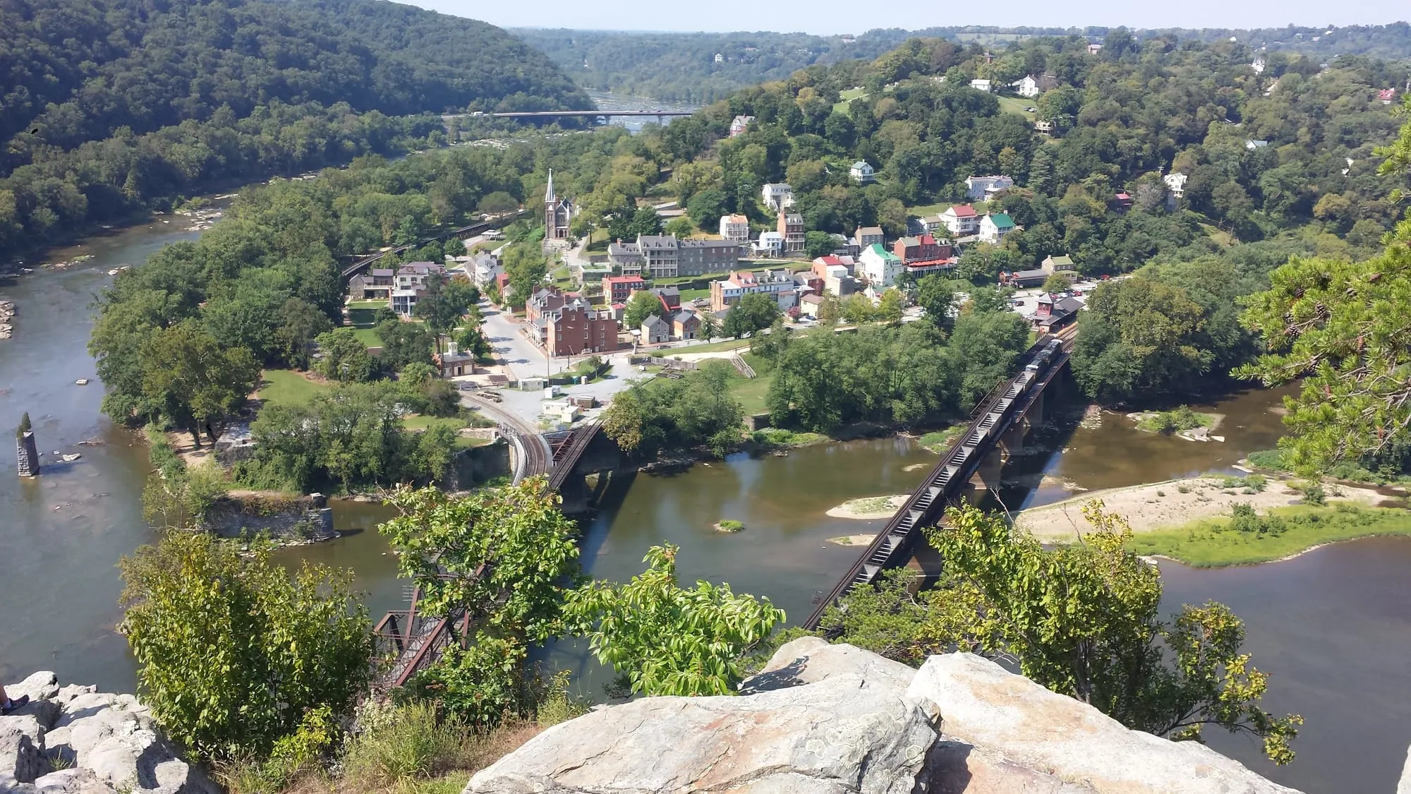
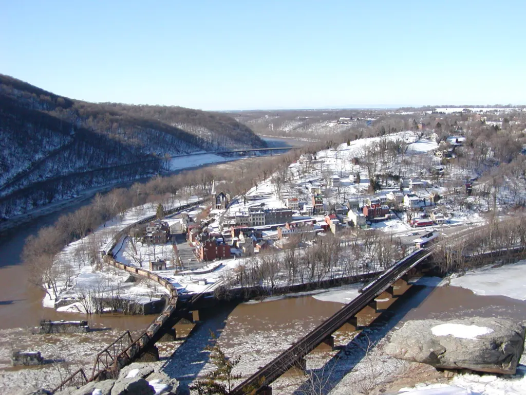
Maryland Heights is the ridge across the Potomac from Lower Town, and its overlook cliffs give the view of Harpers Ferry most people picture: the town, the railroad bridges and the meeting of the Potomac and Shenandoah. The trail is open as of November 2026, but getting to it is harder than usual. Start with the access section below, because the normal route over the footbridge is closed.
Footbridge closed: read this first
The Goodloe Byron Memorial Footbridge, the normal walking route from Lower Town to Maryland Heights, has been closed since July 27, 2026. It first closed to replace its stairs. The closure was later extended for separate deck safety repairs, and as of November 2026 it is "expected to remain closed this fall" with no reopening date. Check the C&O Canal NHP bridge page and the ATC update on the day you go.
Know before you go
| Distance | 4.5–6.5 mi round trip from the trailhead — NPS |
| Climb | 990–1,788 ft |
| Difficulty | Moderately strenuous to strenuous |
| Time | 3–4 hours, plus the shuttle and towpath walk during the closure |
| Access (Nov 2026) | NPS shuttle, Visitor Center to C&O Lock 34; first bus 9:00am, last return 5:30pm from Lock 34 |
| Shuttle limits | Limited seats, no pets, no bike rack, not run in bad weather; about 1 hr round trip |
| Parking | Visitor Center, 171 Shoreline Dr; Sandy Hook Rd lots permanently closed (2022) |
| Water & restrooms | None on the trail |
| Hours | Daylight only (trail page); park trails 30 min before sunrise to 30 min after sunset (hours page) |
| Fee | Park entrance fee applies at the Visitor Center — fees & parking guide |
How do you get to Maryland Heights while the footbridge is closed?
As of November 2026, the only official way in on foot is the NPS shuttle from the Visitor Center to C&O Canal Lock 34, followed by a walk along the towpath to the trailhead. The shuttle runs daily. The first bus leaves the Visitor Center at 9:00am, and the last bus leaves Lock 34 at 5:30pm. The NPS trail page says buses run about once an hour, and the ATC says the round trip takes about an hour.
Know the limits before you count on it:
- Seats are limited. The ATC describes the space as "very limited."
- No pets. Dogs cannot ride, which effectively rules out Maryland Heights with a dog during the closure unless you arrange your own transport.
- No bike rack. One or two bikes may fit at the driver's discretion.
- No service in bad weather. The shuttle does not run on days of inclement weather.
- Watch the clock. The last bus back leaves Lock 34 at 5:30pm. With a 3- to 4-hour hike plus the towpath walk, aim for one of the first buses of the day.
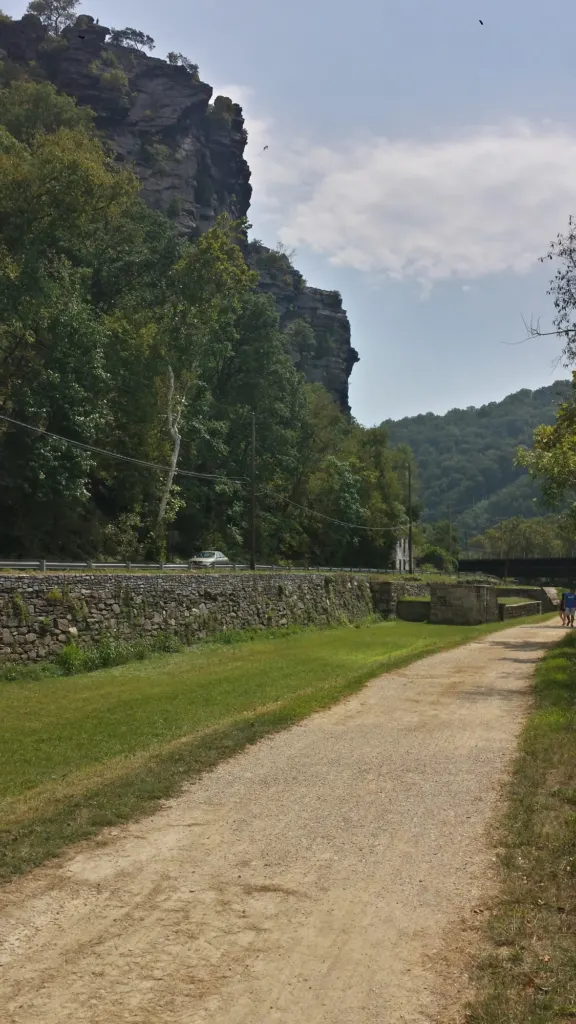
From Lock 34 to the trailhead: Lock 34 sits on the towpath 0.9 miles west (upstream) of the footbridge. The Maryland Heights trailhead is 0.3 miles upstream of the footbridge, so from Lock 34 you walk downstream, toward Harpers Ferry, on the flat towpath, roughly 0.6 miles by those figures. Turn off where a small wooden footbridge crosses the canal bed to Harpers Ferry Road; the trailhead is directly across the road. Watch for traffic when you cross. Ask the shuttle driver or a ranger to confirm the turnoff if you're unsure.
If the park shuttle is full or not running, commercial shuttles are an option. Local operators include River & Trail Outfitters (301-834-9950) and Shepherdstown Pedal & Paddle (304-876-3000).
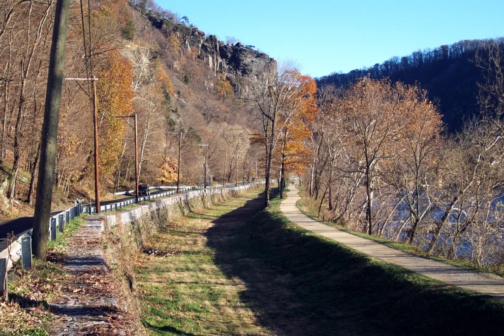
Full timeline and every detour: Harpers Ferry footbridge closure. If the Lock 34 shuttle doesn't work for you (or you have a dog), Weverton Cliffs is a short A.T. hike to a Potomac overlook on the Maryland side that needs no shuttle, and you can walk from Lower Town to the Loudoun Heights Trail and Split Rock.
How do you get to the trailhead when the footbridge is open?
In normal times you walk from Lower Town. The NPS route: from the Master Armorer's House, turn right at the end of Shenandoah Street to join the Appalachian Trail and pass under the railroad trestle to The Point. Cross the footbridge over the Potomac and go down the spiral staircase to the C&O Canal towpath. Turn left (upstream) and follow the towpath for 0.3 miles, then cross the small wooden footbridge over the canal bed to Harpers Ferry Road. The trailhead is directly across the road.
The stairway project will also add a bike ramp when it is finished. Until the NPS announces a reopening, treat this section as reference only.
How long and how hard is the Maryland Heights Trail?
The NPS lists Maryland Heights at 4.5 to 6.5 miles round trip with 990 to 1,788 feet of climbing, rated moderately strenuous to strenuous, taking 3 to 4 hours. The low end is the out-and-back to the overlook cliffs; the high end adds the Stone Fort loop. Expect steep, rocky trail in places.
| Route | Round trip | Climb | Time | What you see |
|---|---|---|---|---|
| Overlook Cliff Trail | About 4.5 mi | From 990 ft | Shorter end of 3–4 hr | Cliffs above Lower Town and the confluence; optional 1862 Naval Battery spur |
| Overlook + Stone Fort loop | Up to 6.5 mi | Up to 1,788 ft | Longer end of 3–4 hr | Adds Civil War artillery batteries, breastworks and the Stone Fort |
Figures are from the trailhead, as published by the NPS and its hikes page. The NPS doesn't break the range down by route, so the split above is approximate. During the footbridge closure, add the towpath walk from Lock 34 each way.
Which route should you take: Overlook Cliff or the Stone Fort loop?
Take the Overlook Cliff Trail if the view is what you came for; add the Stone Fort loop if you have the time and legs for Civil War history and a steep descent. Here is the route as the NPS describes it:
- Start on the green-blazed trail. The first bend gives a view of the Potomac.
- 1862 Naval Battery (optional spur). At the first intersection, go straight to see the Naval Battery, then return to the green trail and turn right.
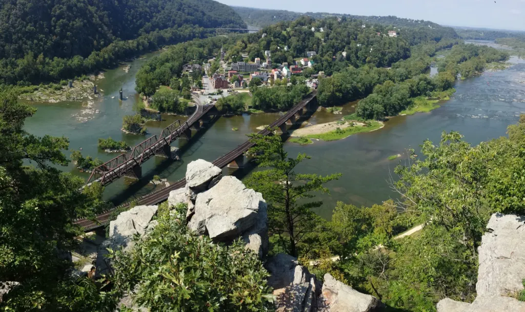
- Overlook Cliff Trail. At the next two intersections, stay straight on the red-blazed Overlook Cliff Trail. About 0.3 miles along, turn right onto a narrow, rocky descent that runs 0.5 miles to the cliffs overlooking Harpers Ferry. Come back the same way.
- Stone Fort loop (optional). Backtrack to the first junction with the blue-blazed Stone Fort Trail. It climbs about 1 mile past Civil War artillery batteries and through boulders to the Stone Fort, then curves past breastworks and descends steeply for about 1 mile back to the green trail.
- Back to the towpath. Turn right on the green-blazed trail and retrace your steps to the C&O Canal towpath.
Why there are forts on the mountain
The batteries, breastworks and Stone Fort on Maryland Heights date from the Civil War, when Harpers Ferry changed hands eight times. On September 15, 1862, Stonewall Jackson's Confederates captured the 12,500-man Union garrison at Harpers Ferry, the largest surrender of U.S. troops in the war. The history hub has the timeline.
Read how these heights decided the 1862 siege in our Harpers Ferry Civil War guide.
What does the sign painted on Maryland Heights say?
The faded painting on the cliff face reads "Mennen's Borated Talcum Toilet Powder." According to the NPS, it was painted in 1906 as an advertisement aimed at passengers on the B&O Railroad. In May 1963 volunteers from the Potomac Appalachian Trail Club tried to cover it at the park superintendent's request, but it was visible again four years later and has been left alone since. You see it from Lower Town, looking across the Potomac.
Is Maryland Heights safe?
Maryland Heights is safe if you treat the cliffs and the climb seriously. The NPS flags cliff edges, slippery rocks, ticks, snakes and dehydration on park trails. On this trail in particular:
- Stay back from cliff edges at the overlook and stay on the marked trail.
- Carry all your water. There is no drinking water and there are no restrooms on the trail.
- Hike in daylight only. The NPS trail page says the trail is closed from sunset to sunrise. During the closure, your real deadline is the 5:30pm last shuttle from Lock 34.
- Wear sturdy footwear. The descent to the overlook is narrow and rocky, and the Stone Fort loop ends with about a mile of steep downhill.
- Pack out your trash. There are no trash cans on park trails or at trailheads.
- Cross Harpers Ferry Road carefully between the canal and the trailhead.
At the overlook
Stay back from the edge. The overlook is a cliff, and the rocks drop away fast. You don't need the lip for the classic shot: Lower Town and both railroad bridges line up from the boulders set back from the drop. The photos of the overlook on this site are mine, taken there in late morning in September 2014.
Where do you park for Maryland Heights?
Park at the Harpers Ferry National Historical Park Visitor Center, 171 Shoreline Drive, off US 340. It has about 1,000 spaces, and it is where the Lock 34 closure shuttle starts. The small Sandy Hook Road lots on the Maryland side (16 spaces) were permanently closed in 2022, so there is no trailhead parking. The park entrance fee covers parking in NPS lots; see our parking, fees and shuttle guide for current prices. If you'd like to start early without a long drive, see where to stay.
Can you bring a dog to Maryland Heights?
Dogs are allowed on park trails on a leash 6 feet or shorter, and you must carry out their waste. However, pets are not allowed on any park shuttle, including the Lock 34 closure shuttle. As of November 2026, that means you cannot reach Maryland Heights with a dog using park transport.
When is the best time to hike Maryland Heights?
Go early in the day, especially during the footbridge closure. Early buses give you time for the hike before the 5:30pm last return from Lock 34, and the trail is open in daylight only. Trail and weather conditions change with the season, so check the live conditions panel above and the NPS conditions page before you set out.
For other trails on both sides of the rivers, see the Harpers Ferry hiking guide.
For peak-color timing and other overlooks, see Harpers Ferry fall foliage.