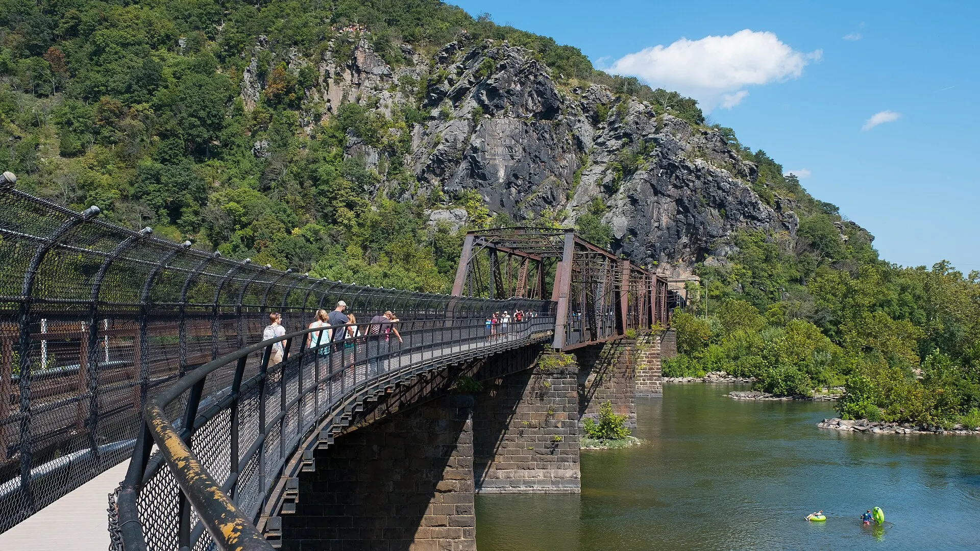
This is the dated status page for the Potomac footbridge at Harpers Ferry: the walkway that carries the Appalachian Trail from Lower Town over the river to the C&O Canal towpath and Maryland Heights. It is re-checked against the National Park Service and the Appalachian Trail Conservancy (ATC) and stamped with the date it was last verified.
Status as of November 8, 2026: CLOSED
The Goodloe Byron Memorial Footbridge is closed to walkers and cyclists, and no reopening date has been announced. It closed on July 27, 2026 for stairway replacement. A separate deck safety repair now keeps it closed, and the ATC says it is "expected to remain closed this fall." Confirm on the C&O Canal NHP bridge page and the ATC trail update on the day you go.
Know before you go
| Footbridge | Closed since July 27, 2026; no reopening date (as of Nov 8, 2026) |
| Why | Stairway replacement, then deck and joist safety repairs |
| Detour shuttle | Visitor Center to C&O Canal Lock 34 only, daily — NPS |
| Shuttle times | First bus 9:00am from the Visitor Center; last bus 5:30pm from Lock 34 |
| Shuttle limits | Limited seats, no pets, no bike rack, no service in bad weather; round trip about 1 hr |
| Park at | Visitor Center, 171 Shoreline Drive (entrance fee applies) — parking & fees |
| Maryland Heights | Trail open; reach it via the Lock 34 shuttle |
| Towpath | Open to through traffic |
| Lower Town | Unaffected by the bridge closure |
Is the Harpers Ferry footbridge open today?
No. As of November 8, 2026, the footbridge across the Potomac at Harpers Ferry is closed, and neither the National Park Service nor the ATC has given a reopening date. The C&O Canal National Historical Park, which manages the stairway project, last updated its bridge page on November 3, 2026. The ATC posted its latest update on November 5, 2026, confirming the bridge "remains closed" and that shuttle hours were shortened for the end of daylight saving time.
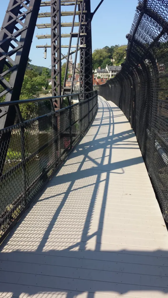
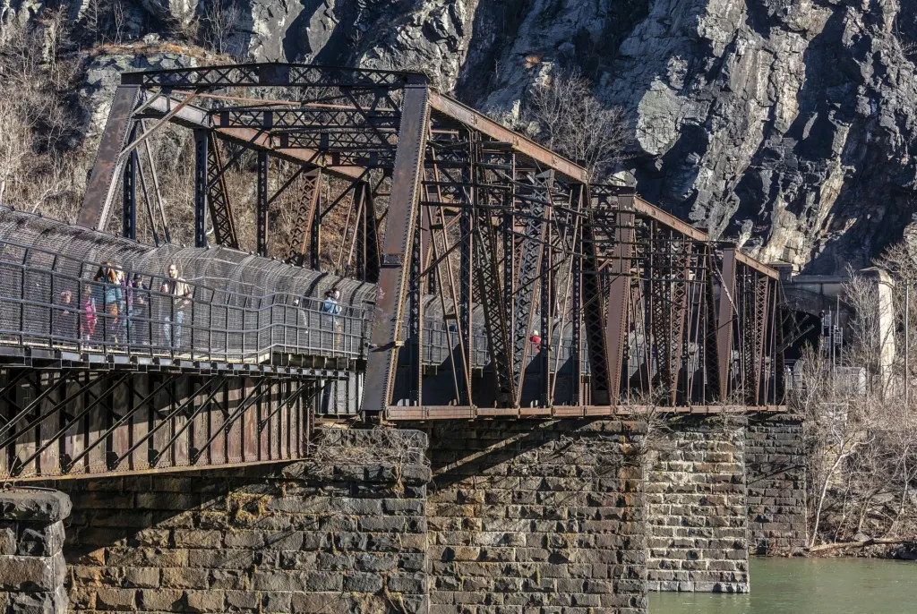
The footbridge is the narrow, fenced walkway bolted to the side of the B&O railroad bridge. On the Maryland end, a spiral stairway (built in 1987) drops about 30 feet to the C&O Canal towpath at roughly mile 60.6. That stairway is what the NPS has been replacing.
Why is the footbridge closed?
Two separate projects have kept the bridge shut since summer 2026. The first is a planned stairway replacement; the second is a deck safety repair that the park ordered after an inspection.
- Stairway replacement. The NPS is replacing the 1987 stairway between the bridge and the towpath. The C&O Canal NHP says the old stair reached the end of its service life, is narrow and hard to use with two-way traffic or loaded bicycles, and has been damaged by scour, debris and flooding. The new $2.6 million stair adds a bike ramp, deeper foundations and erosion protection.
- Deck safety repairs. On September 21, 2026, an NPS condition assessment found deteriorating deck planks and decking joists and a section of security fence that needed stabilizing. The Harpers Ferry superintendent signed a closure determination on September 22, 2026. It says the walkway stays closed "until repairs can be made and inspections completed." The NPS notes that hundreds of pedestrians use the bridge each week.
The park's conditions page describes the deck work as "a separate issue than the staircase construction." So even when the new stairs are done, the bridge will not reopen until the deck repairs are finished too.
What is the full closure timeline?
The footbridge has closed twice for the stairway project. The current closure began on July 27, 2026, and was effectively extended in the fall for the deck repairs.
| Date | What happened | Source |
|---|---|---|
| Fall 2025 | NPS crews mobilize for the stairway replacement | C&O Canal NHP |
| Sept 22, 2025 | Bridge closes for about two weeks to build a temporary stairway; Lock 34 shuttle runs | ATC |
| Oct 6, 2025 | Bridge reopens on temporary stairs; shuttle ends | ATC |
| Feb 20, 2026 | Bridge still open; a second closure expected later in 2026 | ATC |
| July 27, 2026 | Bridge closes so the temporary stairs can be removed and permanent ones installed; Lock 34 shuttle starts | C&O Canal NHP; ATC |
| Sept 3, 2026 | ATC: closed "for several more weeks" | ATC |
| Sept 21–22, 2026 | Inspection finds deck and joist problems; superintendent closes the walkway until repairs and inspections are complete | NPS determination |
| Oct 22, 2026 | ATC: "expected to remain closed this fall" because of safety concerns separate from the stairs | ATC |
| Nov 3, 2026 | C&O Canal NHP says the stair project is in its "final stages" | C&O Canal NHP |
| Nov 5, 2026 | ATC: still closed; shuttle now 9:00am to 5:30pm | ATC |
| Reopening | Not announced | — |
What does the closure cut off?
The closure cuts the walking link between Lower Town and everything on the Maryland side of the Potomac. Lower Town itself is not affected.
| Affected | What it means as of November 2026 |
|---|---|
| Maryland Heights | The trail is open, but the NPS says access "will be challenging." The only park route in is the Lock 34 shuttle and a towpath walk. See the Maryland Heights Trail guide. |
| Appalachian Trail | A.T. hikers cannot cross the Potomac on foot at Harpers Ferry (the crossing is about northbound mile 1,026.7, per the ATC). See below. |
| C&O Canal towpath | The towpath is open, but you cannot walk or ride between it and Lower Town. |
| Bikes | No crossing for cyclists. Normally bikes are walked across the bridge; now the only options are the Lock 34 shuttle (no rack) or a commercial shuttle. |
| Dogs | Pets cannot ride the Lock 34 shuttle, so there is no park transport to Maryland Heights or the towpath with a dog. |
| Lower Town and the regular shuttle | Unaffected. The Visitor Center–Lower Town buses run as usual. |
Four Lower Town museums (Master Armorer's Quarters, Black Voices, the Civil War Museum and Harper House) are also temporarily closed, but for unrelated reasons. See current conditions.
How does the Lock 34 shuttle work?
The NPS runs a limited shuttle between the Harpers Ferry Visitor Center and C&O Canal Lock 34 on the Maryland side, every day, for as long as the bridge is closed. It is the only park option for reaching the towpath and Maryland Heights from the West Virginia side.
| As of November 2026 | |
|---|---|
| Route | Visitor Center (171 Shoreline Drive) to Lock 34 and back; no other stops |
| First bus | 9:00am from the Visitor Center |
| Last bus | 5:30pm from Lock 34 |
| Frequency | About once an hour (NPS Maryland Heights page) |
| Round trip | About 1 hour (ATC) |
| Cost | Described as free by the ATC; the park entrance fee applies to parking at the Visitor Center |
| Seats | Limited; the ATC calls the space "very limited" |
| Pets | Not allowed |
| Bikes | No rack; 1–2 bikes at the driver's discretion |
| Weather | Does not run in inclement weather |
Lock 34 sits on the towpath 0.9 mile west (upstream) of the footbridge, according to the ATC. The Maryland Heights trailhead is 0.3 mile upstream of the footbridge, so from Lock 34 you walk downstream toward Harpers Ferry to reach it.
Plan around the last bus
In July the shuttle ran until 6:30pm. Since the end of daylight saving time, the last bus leaves Lock 34 at 5:30pm. With a 3- to 4-hour Maryland Heights hike plus the towpath walk, take one of the first buses of the day.
What are the other detours?
Besides the park shuttle, you can hire a commercial shuttle or drive yourself to the Maryland side. No official walking detour across the river has been published.
Commercial shuttles. The C&O Canal NHP lists two companies with NPS commercial use authorizations that carry hikers and cyclists. Book and pay them directly:
- River & Trail Outfitters: 301-834-9950, rivertrail.com
- Shepherdstown Pedal & Paddle: 304-876-3000, thepedalpaddle.com
Driving to the Maryland side. You can drive across the Potomac on US 340, but there is no trailhead parking near the footbridge. The small Sandy Hook Road lots below Maryland Heights were permanently closed in 2022. For other towpath access points and parking, check with the C&O Canal NHP (301-739-4200) before you go.
Appalachian Trail road walk. None has been published. As of November 2026 the C&O Canal NHP page says a detour for through-hikers "will be posted," and the ATC page does not describe a road walk. Its advice is to arrange transportation across the river.
What should Appalachian Trail hikers do?
Long-distance A.T. hikers should arrange their own ride across the Potomac, the ATC says, and day or weekend hikers should choose other hikes or stay on one side of the river. The ATC Harpers Ferry Visitor Center at 799 Washington Street (304-535-6331) can help you find transportation. It is open Thursday to Monday 9am–5pm and Tuesday to Wednesday 10am–4pm.
- Northbound: You arrive in Lower Town as usual. To continue north on the towpath, use the Lock 34 shuttle from the Visitor Center (1.4 miles west of where the A.T. crosses Shoreline Drive, per the ATC) or a commercial shuttle.
- Southbound: You come off Maryland Heights and down the towpath to a closed stairway. Walk upstream to Lock 34 for the park shuttle, or arrange a commercial pickup.
- Overnight parking: A.T. hikers can still park at the Visitor Center for up to 14 days with a permit. See parking, fees and shuttle.
For the trail on the West Virginia side, including Jefferson Rock and Loudoun Heights, see the Appalachian Trail in Harpers Ferry guide.
What about cyclists on the C&O Canal?
The towpath stays open to through traffic, but you cannot ride into Lower Town from it. The C&O Canal NHP says crews may hold traffic for about 15 minutes during deliveries and crane lifts, so follow flaggers and signs between Locks 33 and 34.
- Through-riders: Keep going on the towpath; the closure only blocks the side trip into town.
- Riding into Harpers Ferry: The Lock 34 shuttle has no bike rack and takes one or two bikes only if the driver agrees. A commercial shuttle is the reliable option with a bike.
- Riding in the park: Bikes are allowed only on roads open to cars, never on trails (NPS).
More on routes and rentals: biking the C&O Canal from Harpers Ferry.
What can you do instead while the bridge is closed?
Most of Harpers Ferry is on the West Virginia side and unaffected. Good substitutes for Maryland Heights:
- Loudoun Heights: up to 7.5 miles and 1,377 feet of climbing, reached on foot from town across the Shenandoah. See the Loudoun Heights Trail guide.
- Bolivar Heights: an easy to moderate 0.3 to 2.4 miles with an overlook and a replica cannon.
- Jefferson Rock and Lower Town: the stone steps up High Street to the view Thomas Jefferson praised in 1783. See Jefferson Rock and Lower Town.
- Weverton Cliffs: an A.T. overlook on the Maryland side that you drive to rather than walk from town. See the Weverton Cliffs guide.
For timed plans that work around the closure, see the Harpers Ferry itinerary, and the hiking hub for every trail.
Where can you check for reopening news?
Check these official pages the day you go. They usually update before anything else:
| Source | What it covers |
|---|---|
| C&O Canal NHP bridge page | Stairway project, Lock 34 shuttle, towpath impacts |
| ATC trail update | Dated updates, shuttle hours, hiker advice |
| Harpers Ferry NHP alerts | Bridge, trails and museum closures |
| Our current conditions page | River levels, weather and park alerts, refreshed automatically |
By phone: Harpers Ferry NHP 304-535-6029; C&O Canal NHP 301-739-4200; Appalachian National Scenic Trail 304-535-6278; ATC 304-535-6331.
When the bridge reopens, the NPS has said the towpath can still flood at moderate to high water, so the new stairway may close in future storms. If the river is up, check before you walk over.
For everything else about planning a trip, start at plan your visit. If you are staying overnight to catch early shuttles, see where to stay.