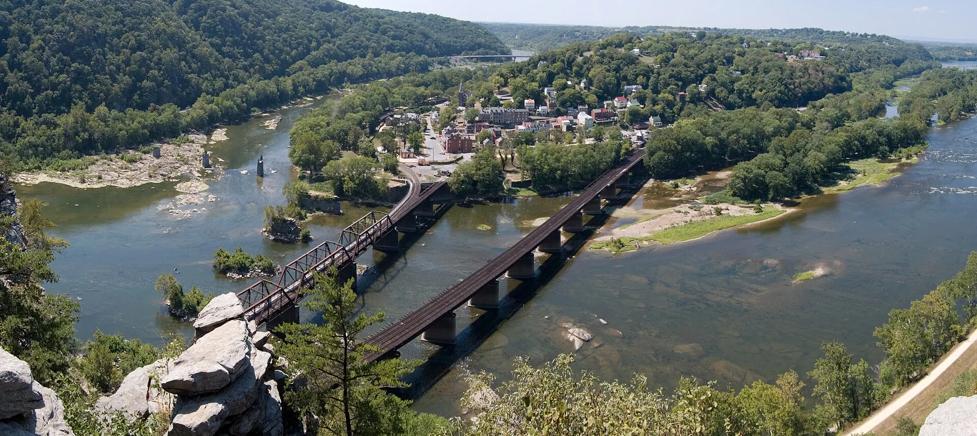
Harpers Ferry spent the Civil War on the border between North and South, and it paid for it. The town changed hands eight times, its armory was burned in the first week of the war, and in September 1862 it saw the largest surrender of U.S. troops of the entire conflict. That surrender also set up the Battle of Antietam two days later. This guide explains why the town mattered, what happened in the 1862 battle, and where you can walk the battlefield today. The facts come from the National Park Service, which preserves the battlefield as part of Harpers Ferry National Historical Park.
Know before you go
| Changed hands | Eight times, 1861–1865; Union-held about 80% of the war — NPS |
| Battle of Harpers Ferry | September 12–15, 1862 |
| Surrender | About 12,500 Union troops on September 15, 1862 (NPS) |
| Battlefield trails | Bolivar Heights, Schoolhouse Ridge North and South, Murphy-Chambers Farm, Maryland Heights |
| Closures (Nov 2026) | Schoolhouse Ridge South southern loop closed (sinkholes); Potomac footbridge to Maryland Heights closed; Civil War Museum in Lower Town temporarily closed — NPS conditions |
| Open in Lower Town | "1862 Battle of Harpers Ferry" exhibit and Provost Marshal's Office |
| Trail hours | Daylight only; bring your own water |
| Fee | Park entrance fee applies, also payable at Bolivar Heights — fees & parking guide |
Why did Harpers Ferry change hands eight times?
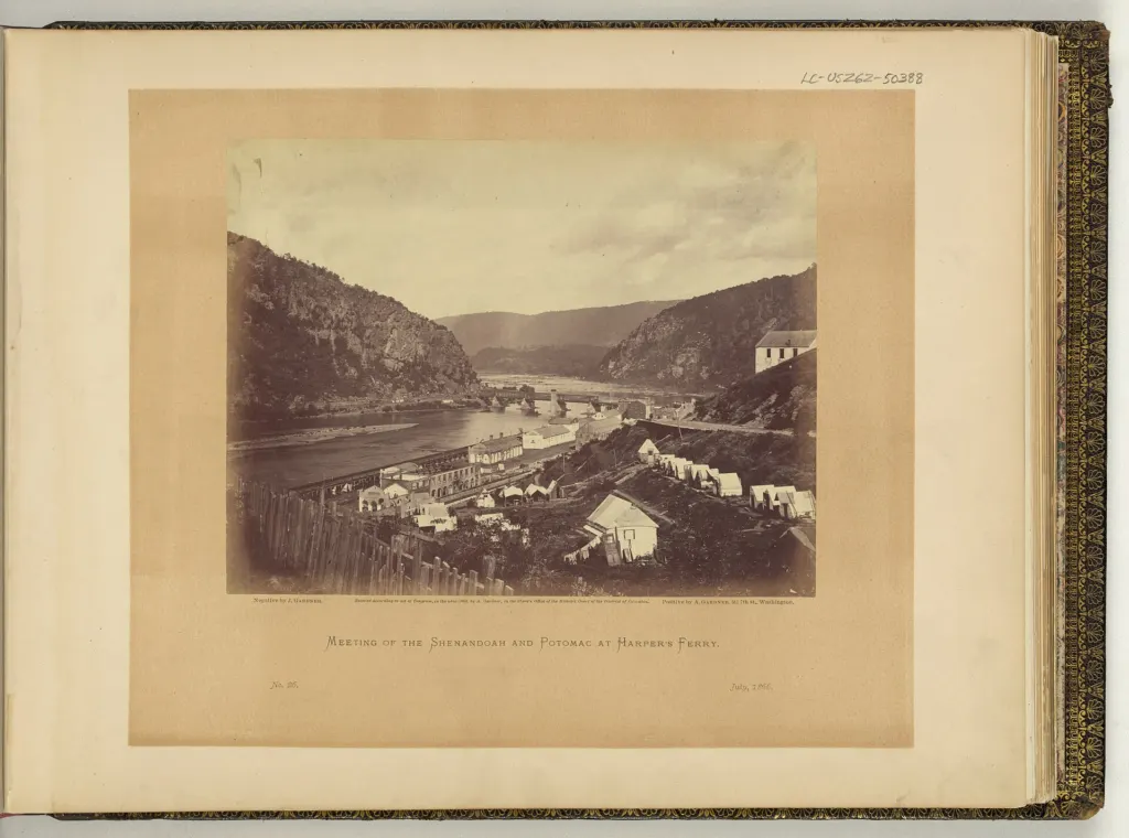
Harpers Ferry changed hands eight times because it was worth taking but almost impossible to hold. The NPS lists what made it valuable: a U.S. Armory with more than 20 factory buildings and 400 workers, the Baltimore & Ohio Railroad, and the Chesapeake & Ohio Canal, all at the meeting of the Potomac and Shenandoah. The town was, in the park's words, "strategically important to both sides."
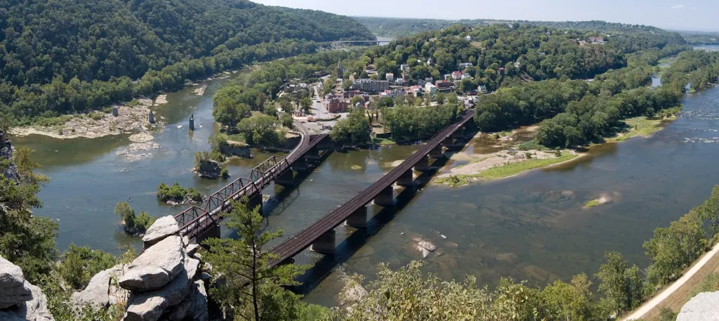
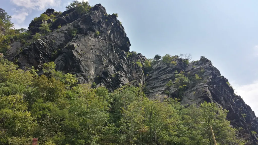
The problem was the ground. Lower Town sits at river level, ringed by higher ridges: Maryland Heights across the Potomac, Loudoun Heights across the Shenandoah, and Bolivar Heights and Schoolhouse Ridge to the west. Maryland Heights, at 1,448 feet, is the highest ridge overlooking the town. Whoever held the heights could shell the town below, so garrisons tended to pull back when a larger army arrived. The NPS says Union forces held Harpers Ferry for about 80 percent of the war.
What happened at Harpers Ferry in the Civil War? A timeline
From the first days of the war to its last year, Harpers Ferry was a target, a garrison and a supply base. These dates come from the NPS park chronology.
| Date | What happened |
|---|---|
| Apr 18, 1861 | A day after Virginia votes to secede, U.S. soldiers burn the armory and arsenal, destroying more than 15,000 weapons |
| Apr 28, 1861 | Col. Thomas J. Jackson takes his first war command at Harpers Ferry; armory machinery is shipped south to Richmond and Fayetteville, NC |
| Jun 14, 1861 | Withdrawing Confederates burn the B&O railroad bridge and armory buildings |
| Oct 16, 1861 | Battle of Bolivar Heights: about 500 Confederates under Col. Turner Ashby clash with about 600 Federals under Col. John Geary |
| Feb 7, 1862 | Union soldiers burn the commercial area near The Point after a scout is killed by snipers |
| Feb 25, 1862 | Federals reoccupy the town; about 14,000 soldiers are eventually stationed there |
| Sep 13–15, 1862 | Confederates surround the garrison; about 12,500 Union troops surrender on September 15 |
| Sep 17, 1862 | Battle of Antietam, "the single bloodiest day in American history" |
| Sep 20, 1862 | Federals reoccupy Harpers Ferry |
| Jun 17, 1863 | Federals leave the town and man the forts on Maryland Heights during the Gettysburg campaign |
| Jun 20, 1863 | West Virginia is admitted to the Union |
| Mar 19, 1864 | Men are recruited in the town for the 19th U.S. Colored Troops |
| Jul 4–7, 1864 | Jubal Early pushes the garrison back to Maryland Heights, fails to dislodge it, then marches toward Frederick, MD |
| Aug 6, 1864 | Gen. Philip Sheridan arrives to plan his Shenandoah Valley campaign against Early |
| Apr 9, 1865 | Lee surrenders at Appomattox Court House |
What happened at the Battle of Harpers Ferry in 1862?
The Battle of Harpers Ferry, September 12–15, 1862, ended with Stonewall Jackson trapping and capturing the town's Union garrison. After crossing into Maryland on September 4, Robert E. Lee expected the roughly 14,000 Union troops at Harpers Ferry and Martinsburg to withdraw. They stayed, so Lee's Special Order 191 split his army and sent three columns, almost 23,000 men, to surround the town.
The NPS describes how the trap closed:
- Maryland Heights, September 13. Gen. Lafayette McLaws's Confederates attacked along the ridge at sunrise and, after about nine hours of fighting, drove 4,600 Union defenders off the mountain.
- Loudoun Heights, September 14. Gen. John G. Walker's guns opened fire from the Virginia side. Col. Dixon Miles, the Union commander, had posted no troops there.
- Schoolhouse Ridge, September 13–14. Jackson's own 14,000-man column, after marching 51 miles in less than two days and taking Martinsburg, occupied the ridge facing the Union line on Bolivar Heights.
- The flank, night of September 14. Gen. A.P. Hill used Schoolhouse Ridge as cover to move guns across the Shenandoah and onto the Chambers (later Murphy) Farm, beyond the Union left.
- The escape. That same evening, Col. Benjamin "Grimes" Davis led about 1,500 Union cavalry across the Potomac on a pontoon bridge. They rode 50 miles in 12 hours to Greencastle, Pennsylvania, capturing a 91-wagon Confederate ammunition train on the way.
- The surrender, September 15. At about 9:00am white flags went up along Bolivar Heights. Minutes later a shell mortally wounded Col. Miles, and Brig. Gen. Julius White completed the surrender.
As one Union captain wrote, quoted by the NPS: "We are as helpless as rats in a cage."
How many Union troops surrendered at Harpers Ferry?
About 12,500 Union troops surrendered at Harpers Ferry on September 15, 1862, the largest surrender of U.S. forces during the Civil War. The NPS park chronology calls it the largest surrender of Federal troops in American history until the fall of Bataan in World War II. Counts vary a little by source:
| Source | Figure |
|---|---|
| NPS park chronology and "Harpers Ferry by the Numbers" | About 12,500 |
| NPS "The Fall of Harpers Ferry" | Over 12,500 captured |
| NPS "1862 Battle of Harpers Ferry" | Over 12,700 captured |
| Wikipedia | 12,419 captured, plus 44 killed and 173 wounded |
The NPS also lists 13,000 small arms and 47 pieces of artillery taken. We use "about 12,500" on this site because that is the park's standard figure.
How is the Battle of Harpers Ferry connected to Antietam?
The capture of Harpers Ferry and the Battle of Antietam were two halves of the same campaign. Lee divided his army to take Harpers Ferry, and on the morning of September 13, 1862, Union soldiers near Frederick, Maryland, found a copy of Special Order 191, the "Lost Order" that laid out his plan, and passed it up to the Union command while Lee's army was still spread out.
After the surrender on September 15, Jackson left A.P. Hill at Harpers Ferry to parole the prisoners and hurried the rest of his men to Sharpsburg. On September 17, as the Battle of Antietam raged, Hill left a brigade behind and marched his "Light Division" 17 miles from Harpers Ferry to the battlefield. The NPS says his tired troops "slammed into the exposed Union left flank" late in the day and drove it back. Antietam was the bloodiest single day in American history, and five days later, on September 22, Lincoln issued the preliminary Emancipation Proclamation.
Antietam National Battlefield is near Sharpsburg, Maryland. See our Antietam day-trip guide to pair the two battlefields.
Where can you walk the Harpers Ferry battlefield today?
You can walk most of the 1862 battlefield on National Park Service trails west and south of town, each with a small parking area of its own. Trails are open in daylight only, and bikes are not allowed on them.
| Site | 1862 role | Trail (NPS) | Parking |
|---|---|---|---|
| Bolivar Heights | Union line; white flags raised Sep 15 | 0.3–2.4 mi round trip, easy to moderate | End of Whitman Ave (8 spaces); Bakerton Rd lot for Lower Loop (10) |
| Schoolhouse Ridge North | Jackson's 14,000-man position facing Bolivar Heights | 1.7–2.1 mi round trip, about 1 hr | 874 Bakerton Rd (7 spaces) |
| Schoolhouse Ridge South | Confederate batteries, including Courtney's Battery | Up to 3.7 mi; southern loop closed (Nov 2026) | 2083 Millville Rd (7 spaces) |
| Murphy-Chambers Farm | A.P. Hill's flanking position above the Shenandoah | 1–3 mi round trip; 0.75 mi to the overlook | 123 Murphy Rd (7 spaces) |
| Maryland Heights | Union defenses taken Sep 13; later forts | 4.5–6.5 mi round trip, strenuous; footbridge closed | Visitor Center, then the Lock 34 shuttle |
Bolivar Heights
Bolivar Heights is where the Union army made its stand and where it surrendered. A short 0.3-mile overlook loop has cannon and earthworks, and longer loops add views of Schoolhouse Ridge, the Potomac water gap and the Shenandoah Valley. A connector across Bakerton Road links to Schoolhouse Ridge North, making a 4.1-mile walk across both armies' lines. Portable toilets are at the Whitman Avenue lot, but there is no drinking water. Bolivar Heights was also the site of a smaller fight on October 16, 1861.
Schoolhouse Ridge North and South
Schoolhouse Ridge is the Confederate side of the battlefield. The NPS calls Schoolhouse Ridge North "the best place to survey the terrain" and the view there shows the ground from the Confederate side in 1862, with cannon along a walk through farm fields. Schoolhouse Ridge South has two trails from the Millville Road lot: Courtney's Battery Trail (1.2 miles) to a Confederate gun position, and the 2.5-mile Allstadt Farm Trail past farmhouse ruins. As of November 2026 the southern loop is closed because of sinkholes, so check the NPS conditions page before you go.
Murphy-Chambers Farm
The Murphy-Chambers Farm is where A.P. Hill "struck the winning blow" of the battle, in the NPS's words. Union soldiers had forced the farm's owner, Edmund Chambers, from his home in 1862, and Gen. Philip Sheridan built earthworks here in 1864. The trail runs through fields and wooded ravines to an overlook of the Shenandoah, with cannon and earthworks along the way; stay off the fragile earthworks. Near the overlook is the site where John Brown's Fort stood from 1895 to 1909.
Maryland Heights forts
Maryland Heights holds the forts and batteries the Union built to keep the high ground. The NPS says the Naval Battery, built in May 1862 with guns from the Washington Navy Yard, was the first Union fort on the mountain, and that the Stone Fort was built to command the mountain's highest point during the winter of 1862–1863. The 4.5- to 6.5-mile hike is strenuous. As of November 2026, the Potomac footbridge is closed, so the trail is reached by the NPS shuttle to C&O Canal Lock 34; see the Maryland Heights Trail guide and the footbridge closure update.
Where can you learn about the Civil War in Lower Town?
In Lower Town, the "1862 Battle of Harpers Ferry" exhibit and the Provost Marshal's Office are open as of November 2026, but the Civil War Museum is temporarily closed. Lower Town buildings are generally open 9am to 5pm. Park at the Visitor Center and take the shuttle; parking in Lower Town is very limited. Our parking, fees and shuttle guide has current prices and shuttle times.
For the wider story, from the armory to Storer College, see the Harpers Ferry history hub and our guides to the Harpers Ferry Armory and John Brown's raid, which helped bring on the war. For more walks, see the Harpers Ferry hiking guide, and for a base for a two-battlefield weekend, see where to stay.