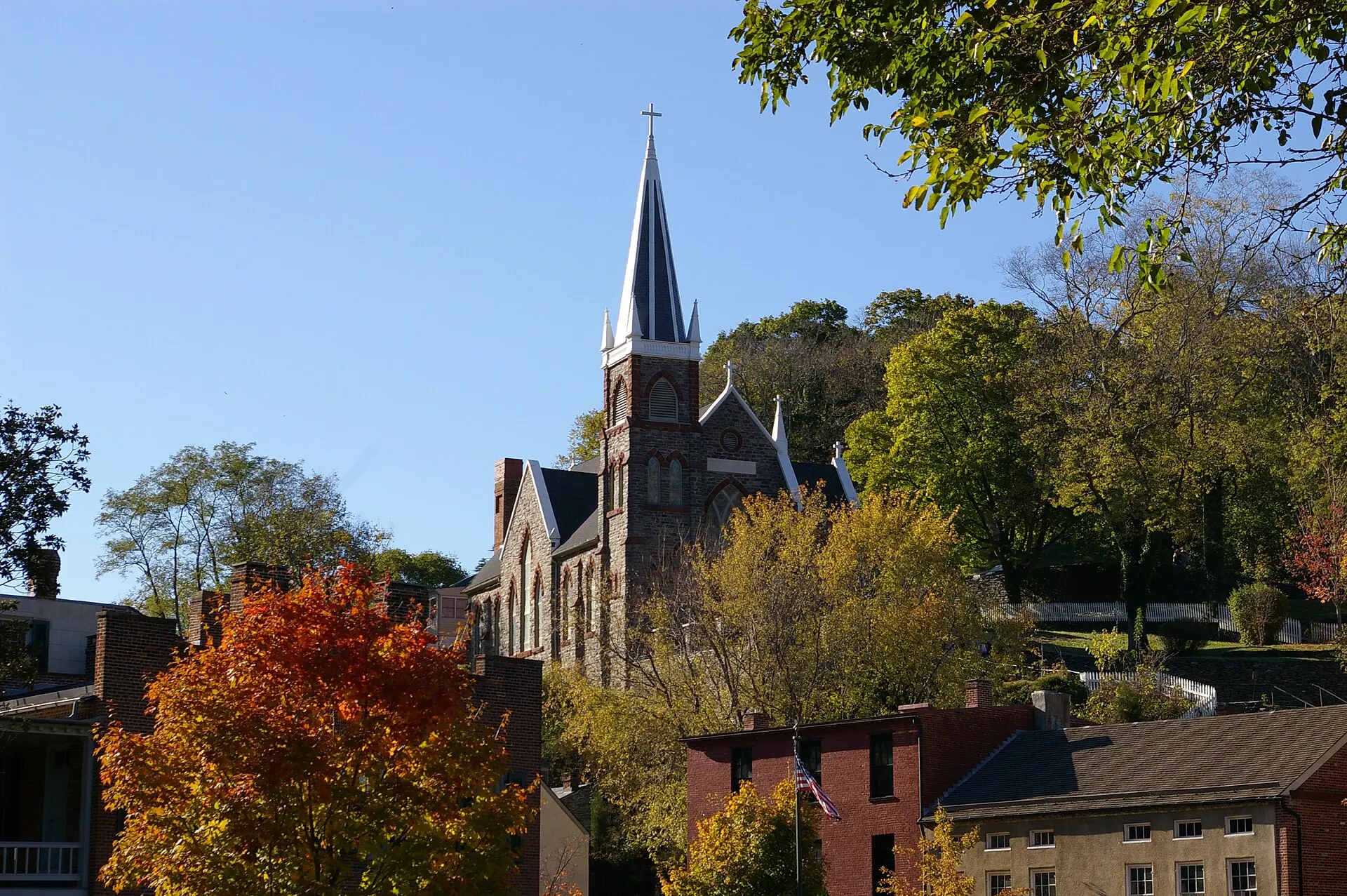
Fall is when Harpers Ferry looks most like its postcards: the hills above the Potomac and the Shenandoah turn amber and red around the church steeples and stone buildings of Lower Town. It is also Daniel's favorite season here; the color around town and on the hills makes for the best pictures of the year. This guide covers when the color usually peaks, what our year-by-year record shows, where to see it, and how to handle fall crowds while the footbridge is closed.
Know before you go
| Typical peak | Late October into early November |
| Our record's typical window | About October 20 to November 5 (approximate, from WV Tourism maps 2024–2026) |
| Live color reports | WV Tourism fall foliage page, updated weekly in season |
| Footbridge (Maryland Heights) | Closed as of November 2026; NPS shuttle to Lock 34 — footbridge guide |
| Easiest viewpoint | Bolivar Heights, from 0.3 mi, easy — NPS |
| Parking | Visitor Center lot (about 1,000 spaces) plus shuttle — parking guide |
| Last shuttle | 7pm in daylight saving time; 5:30pm after DST ends (Nov 1, 2026) — NPS |
| Entrance fee | $20 per vehicle, valid 3 days, no cash (as of Nov 2026) — NPS |
When does fall foliage peak at Harpers Ferry?
Fall color at Harpers Ferry usually peaks in late October and often holds into early November. That is later than most of West Virginia. Color moves from the high mountains down to the lowlands, and Harpers Ferry sits at about 247 feet above sea level at the river confluence, the lowest point in the state, according to the Town of Harpers Ferry.
West Virginia Tourism publishes a projection map each August and weekly color reports through the season. Its 2026 projection, released in August, put the panhandles in "late October and early November." Its 2025 map gave the panhandles the same late October to early November window. Peak varies with each year's rain and temperatures, so treat any date as a guide and check the weekly WV Tourism map before you drive.
What does our year-by-year foliage record show?
Harpers Ferry Guide keeps a year-by-year record of fall foliage timing for Harpers Ferry and the Eastern Panhandle, built from West Virginia Tourism's projection maps and weekly reports. The table below is that record. The windows are our approximations of the published wording (for example, "late October to early November"), not official day-level dates.
| Year | WV Tourism projection for Harpers Ferry / the panhandles | Our approximate window | What was reported during the season |
|---|---|---|---|
| 2023 | Statewide only: high elevations late September to the Ohio Valley lowlands in late October. No Eastern Panhandle window found | Not recorded | — |
| 2024 | Harpers Ferry and the easternmost counties: wait until mid- to late October; Eastern Panhandle color possible into early November | Oct 15 – Oct 31 | By October 31, every region showed color, and WV Tourism said color was "lasting longer than ever" |
| 2025 | Panhandles: late October to early November | Oct 20 – Nov 7 | Week of October 22: lower elevations reaching peak |
| 2026 | Panhandles: late October and early November (map released August 19) | Oct 20 – Nov 7 | WV Tourism's October 27 report said color was popping up all over the state ahead of Halloween weekend |
| Typical | Late October into early November | About Oct 20 – Nov 5 | Synthesis of 2024–2026 |
Source: Harpers Ferry Guide records, compiled from West Virginia Tourism projection maps and weekly reports (2023–2026), checked November 8, 2026. See Sources below.
The pattern is consistent: in each year with a panhandle forecast, the window starts in mid- to late October and runs into early November. If you can only pick one weekend, the last weekend of October fell inside our window in every year with a panhandle forecast (2024, 2025 and 2026).
Where are the best fall foliage viewpoints at Harpers Ferry?
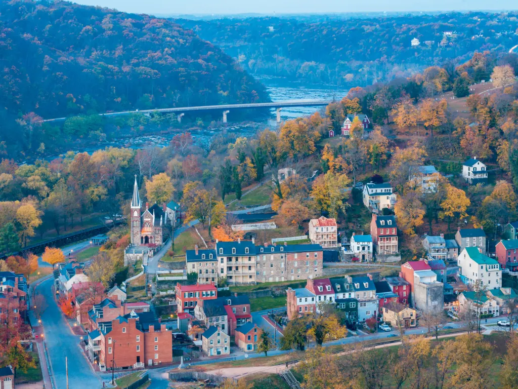
The best fall views at Harpers Ferry are from the heights above town: Maryland Heights, Loudoun Heights and Weverton Cliffs for big views, and Jefferson Rock and Bolivar Heights for short walks. Here is how they compare as of November 2026:
| Viewpoint | Effort (NPS figures) | How to get there now | What you see |
|---|---|---|---|
| Maryland Heights overlook | 4.5–6.5 mi round trip, 990–1,788 ft climb, 3–4 hr | NPS shuttle to Lock 34, then the towpath (footbridge closed) | Lower Town, both rivers and the railroad bridges from the cliffs |
| Loudoun Heights | Up to 7.5 mi, 1,377 ft climb, 4–5.5 hr | A.T. across the US 340 Shenandoah bridge, Virginia side | Maryland Heights, the town and the confluence |
| Weverton Cliffs | See our guide | Separate A.T. trailhead in Maryland | The Potomac valley downstream of Harpers Ferry |
| Jefferson Rock | Short, steep climb on stone steps | Walk up from High Street past St. Peter's | The view Jefferson described: the Potomac passing through the Blue Ridge |
| Bolivar Heights | 0.3–2.4 mi, easy to moderate | Small lot on Whitman Avenue (8 spaces) | Overlook and replica cannon on the 1862 battlefield |
| The Point | Flat walk in Lower Town | Shuttle to Lower Town | Three states and the confluence, at river level |
Maryland Heights: the classic view, by shuttle for now
The Maryland Heights overlook gives the most famous view of Harpers Ferry: the town, the bridges and the meeting of the rivers framed by fall color. The NPS lists the hike at 4.5 to 6.5 miles round trip with 990 to 1,788 feet of climbing, about 3 to 4 hours. As of November 2026 the Potomac footbridge is closed, so the only official route is the NPS shuttle from the Visitor Center to C&O Canal Lock 34, then a walk along the towpath to the trailhead. The first bus leaves the Visitor Center at 9:00am and the last bus leaves Lock 34 at 5:30pm. Seats are limited, pets can't ride, and the shuttle doesn't run in bad weather. Our Maryland Heights Trail guide has the step-by-step route.
Loudoun Heights: the big view without the footbridge
Loudoun Heights is on the Virginia side, reached on the Appalachian Trail across the US 340 bridge over the Shenandoah, so the footbridge closure doesn't affect it. The NPS lists up to 7.5 miles with 1,377 feet of climbing, 4 to 5.5 hours, with views of Maryland Heights, the town, the rail lines and the confluence. See the Loudoun Heights Trail guide.
Weverton Cliffs: a Maryland overlook with its own trailhead
Weverton Cliffs is an Appalachian Trail overlook above the Potomac in Maryland, downstream of Harpers Ferry. You reach it from a separate trailhead on the Maryland side rather than from Lower Town, which makes it a useful fall option while the footbridge is closed. Distances, parking and the climb are in our Weverton Cliffs guide.
Jefferson Rock: a short climb with history
Jefferson Rock is a short walk above Lower Town on the Appalachian Trail, reached by the stone steps on High Street past St. Peter's Church. Thomas Jefferson stood here on October 25, 1783, right in what is now peak foliage season, and wrote that the view was "worth a voyage across the Atlantic." Climbing on or moving the rock is prohibited, and the steps aren't accessible to people with mobility limitations. More in our Jefferson Rock and Lower Town guide.

Bolivar Heights: the easiest fall view
Bolivar Heights is the easiest foliage stop: the NPS lists walks from 0.3 to 2.4 miles, easy to moderate, with an overlook and replica cannon on the 1862 battlefield. Its lot on Whitman Avenue holds only 8 cars, so go early or late in the day.
How do you handle fall crowds and parking?
Park at the Visitor Center and ride the shuttle. Lower Town parking is "extremely limited," according to the NPS: the Train Station lot has 81 spaces and the River Access lot has 36. The Visitor Center lot at 171 Shoreline Drive has about 1,000 spaces, and shuttles run to Lower Town every 10 to 15 minutes. Expect fall weekends to be busy.
- Arrive early. Trails and parking lots open 30 minutes before sunrise, and the first shuttle leaves at 9am.
- Watch the last shuttle. It runs until 7pm during daylight saving time and 5:30pm after DST ends (November 1 in 2026). On a late-October trip you get the longer hours; in early November, plan around 5:30pm.
- Pay ahead. The entrance fee is $20 per vehicle, valid 3 days, and the park doesn't accept cash (as of November 2026). Details on our parking, fees and shuttle guide.
- Pick a weekday if you can. The 2026 fee-free days included October 27 and November 11 (Veterans Day), which can add visitors.
- Pack out your trash. There are no trash cans in the park.
- Book a room early. Harpers Ferry has only a few inns; see where to stay or camping near Harpers Ferry.
What else is there to do in Harpers Ferry in the fall?
October is also when the park marks the anniversary of John Brown's raid (October 16–18, 1859) with programs; see John Brown's raid. After a hike, the wineries and breweries around Hillsboro, Virginia, are at their busiest in foliage season; see breweries and wineries near Harpers Ferry. Lower Town also has evening ghost tours; check the operators' schedules. For the rest of the year, see Harpers Ferry by season.